by Paul Devlin
What makes safety inspection services “essential” and what makes it an optimal time to perform these services?
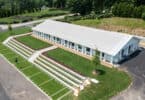
With the reboot of the economy, it’s safe to say, construction sites will operate differently than the one we have left. Social distancing is here to stay. With the Leica 3D scanners project, stakeholders have access to survey-grade accuracy, scanning speed, high production rate, and high-quality data, all done without having to make trips out to the field.
Point cloud data from 3D scanning is the backbone of BIM models that are used in ongoing coordination meetings that are happening in real-time. With this current scan data, better more informed decisions can be made.
What are the applications and benefits of documentation?
Key applications for construction include as-builts, progress scanning, 3D documentation, clash detection, BIM, AutoCAD and Revit-based 3D deliverables, and improved AEC workflows.
On a typical construction project, rework accounts for 12-15% of the cost of construction. With laser scanning, the ability to catch conflicts before they happen can reduce rework to 1-3% or less. This reduction translates into hundreds of thousands of dollars in savings on change orders, not to mention the advantage of keeping the project on schedule.
For architects and general contractors, this insight is the single largest benefit of laser scanning. Laser scanning helps lower contractor risks by ensuring as-built drawings are accurate and by exposing any inaccuracies early in the process before they turn into change orders during construction.
What kinds of technology are involved?
Laser scanning is a method of high-accuracy mapping or reality capture that uses laser beams to quickly capture complete detail of the entire building construction project, much like a camera taking a 360-degree photo, but with an accurate position for every pixel. This detailed 3D representation of the building project is often called a point cloud. Originally applied in the construction and maintenance of industrial plant facilities, laser scanning has since been adopted for many other uses, including building construction and building information modeling (BIM).
What are the different options for carrying out this type of work?
When it comes to capturing a great point cloud data set, Jason Brooks, Makepeace’s scanning manager, considers it an art. Using the Leica equipment, Jason can capture the area with the scanner like a painter creates their mural. Keep in mind, this process is not just a man and his scanner – it’s an integrated system. The Leica RTC360 and Cyclone FIELD 360 work in tandem in the field is fed into Cyclone REGISTER 360 software.
Using the Leica gear has allowed us to focus on improving productivity throughout the process, and especially looking for ways to apply automation upfront, to speed the back end. This technology helps Jason deliver a precise, complete representation of the space.
Makepeace can assign one of our scanning technicians to go on location with the Leica scanners and tripods to document the site. The scanner technician is a one-man force that is equipped with the best Leica equipment and has the tools he needs to capture the necessary scans in any space. He has tripods that can go up to 13 feet in the air to capture above drop ceilings and can capture spaces with high open ceilings like mechanical rooms.

Paul Devlin
Paul Devlin is Makepeace‘s VDC solutions director.