Toward Resource Self-sufficiency – One Region at a Time
by Phillip Norton Loheed
As president of Earthos Institute, I have helped to create Bioregional Urbanism, a process to encourage changes back to “One Planet Living.” This is the sixth of ten installments describing Bioregional Design principles.
The timeline for our hypothetical town reconfiguration will need to reflect the rate of sea level rise with immediate adaptation, with longer term morphology and intelligent planning for life cycle costs as the levels of risk evolve.
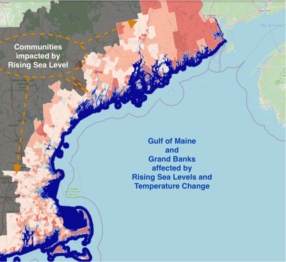
Some concerns and opportunities are being felt simultaneously by all sea-related communities [see map by NOAA]; and for the Boston Bioregion the entire Gulf of Maine “transect” is being studied by an international group of stakeholders and scientists. The transect under study includes the Canadian maritime provinces related to the Bay of Fundy.
Numerous changes in the living systems of both the land and ocean are occurring with increasing urgency requiring husbandry and management to mitigate, adapt, and, at times, retreat in a continuous fashion over this century.
Clearly, as water, food, and energy needs; equity for the people; Biodiversity restoration; land constraints; and waste as resource systems are studied in terms of immediate local, long term regional and global impacts – to set goals and inform action plans – a bioregional perspective is critical.
The most obvious infrastructure needs for the region include transportation system planning, communication and resource monitoring systems, resource consumption budgets, food chain continuity, and several others. How can the timeline for actions work when the rate of sea level rise is generally increasing, but with several unknowns in play? Our suggested approach relates the creative timeline to the various levels of risk by contour elevations above current sea level:
0-10 meters, 90-100% risk of inundation inform short term actions such as:
• flood control works;
• buy-outs, tax credits, transferable development rights, etc. to mitigate equity losses of citizens;
• interim water, food, transportation and communication systems.
10-30 meters, 50-80% risk of future inundation and other systemic changes inform medium-term actions with acceptable life-cycle risks if inundation should occur:
- Housing at secure sites during reasonable amortization periods;
- Business development of modified resource base (land and ocean);
- Medium term infrastructural systems.
30-60 meters, 20-60% risk of inundation and systemic changes can inform long-term actions for minimal future impact to critical resources and infrastructure:
- Regional transportation connectors;
- interconnected water, food, energy systems;
- larger scale business enterprises;
- renewable resource management.
60-70 meters, 0-10% risk of inundation. Most critical long term resources and infrastructure are very unlikely to be affected by ocean levels:
• Globally important medical facilities;
• regional rail, communications, other institutions.
The strategic categories outlined above show the potential benefits of “worst case” analysis, used to structure investments in the future self-sufficiency and resilience of a bioregion based upon perceived risk levels.
A core question:
What investments, profitable now, will benefit resilience and self-sufficiency of our communities as negative feedback from natural systems occurs in the future?
Please tune in next month.

Philip Norton Loheed
Phillip Norton Loheed is a principal at Design Partnership Plus.